Spatial climate variables for downloading individually
|
Meta data
*ClimateNA version: v7.41
*File format: georeferenced tiff file
*Spatial resolution: 0.0083333 x 0.0083333 (about 800 x 800 meter)
for Western North America and 0.041666 x 0.041666 (about 4 x 4 km) for North
America
*Projection: geographic coordinate system: GCS_WGS_1984
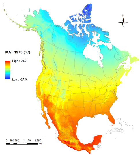
*Coverage: North America or western North America as shown in the map
*Historical normals: 1961-1990, 1971-2000, 1981-2010, and 1991-2020
*GCMs: 8-GCM ensembles and their individual GCMs for SSP126, SSP245, SSP370, SSP585 SP245, SSP370, SSP585
*Historical years: North America only
Download steps:
1. Click on the dropdown boxs to select a category, period and time scale of climate variables;
2. Click on each climate variable listed in the left panel to download the ones of your interest;
3. The right panel shows the climate variables that you have downloaded;
4. After downloading the variables of a selected period, please organize the downloaded files on your local computer before downloading climate variables for a different period.
The R package ClimateNAr allows to download multiple climate variables programmly.
|
Coverage of ClimateBC raster files indicated by Tmin01
|
|
|
Click to download
Downloaded variables
|
Note: The downloaded files are automatically saved to your Downloads folder on
your computer if you use Chrome, Edge or Firefox, but it requires an additional step with IE (to choose open or save).
More spatial climate data generated with ClimateNA for the entire North America at the resolution of 1x1 km are freely availlable at: